Residents take shelter from ashfall
Ismail Damar, head of the Sariak Disaster Preparedness Village (KSB) and a local hamlet chief, described conditions in Nagari Sariak while speaking in Bukittinggi on Saturday.
"Volcanic ash fell in Nagari Sariak, Sungai Pua. It severely affected visibility and made breathing difficult," he said.
Ismail said extensive areas of farmland and plantations on Marapi's slopes were covered in ash. He had been working in a garden and took refuge in a hut to limit his exposure.
Monitoring results and alert status
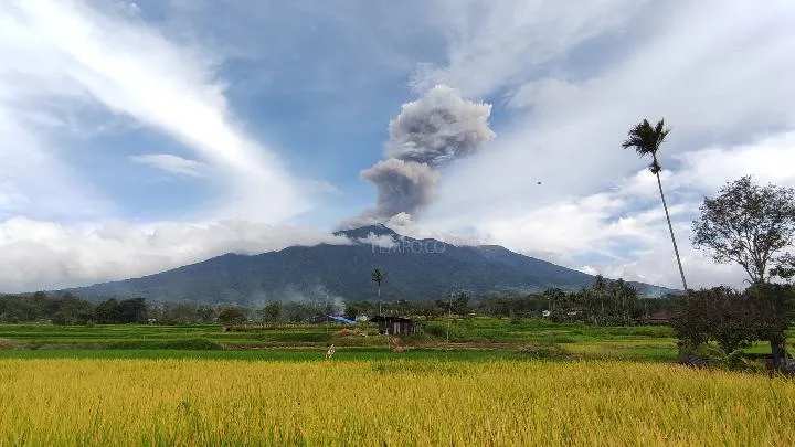
The eruption lasted about 48 seconds, with a maximum seismograph amplitude of 15.6 millimeters, according to Ahmad Rifandi of the Mount Marapi Observation Post. Observers at the post could not determine the ash column's height.
Marapi's alert status remains at Level II, the second-lowest tier of Indonesia's four-level system. Wikipedia's account of the 2023 eruption says the volcano has held that status, known as Waspada, since 2011 under the system established by the Volcanological Survey of Indonesia.
The same account describes Marapi's eruptions as difficult to predict. Their geological sources are shallow and close to the peak, rather than involving deep magma movement that seismic monitors can detect as volcanic earthquakes.
A history of deadly eruptions
Marapi stands between Agam and Tanah Datar regencies in West Sumatra Province, reaching 2,891 meters (9,485 feet) above sea level, according to The Watchers.
An eruption on December 3, 2023, killed 23 climbers caught on the mountain's slopes; another victim later died from injuries, according to Wikipedia's account. It was Marapi's deadliest eruption since the 1979 eruption, which killed 60 people.
The Watchers reports that Indonesia has about 130 active volcanoes. The country lies along the Pacific Ring of Fire, where the Indo-Australian Plate moves beneath the Eurasian Plate, generating intense volcanic and seismic activity.
Exclusion zone and health precautions
The Center for Volcanology and Geological Hazard Mitigation (PVMBG) advises residents, hikers and tourists to keep at least three kilometers from Verbeek Crater, the eruption center.
People near valleys or rivers that originate at the summit have also been warned about possible lahars, particularly when rain falls around the summit.
During ashfall, residents are advised to cover their nose and mouth with a mask to reduce the risk of acute respiratory infections. Authorities have asked the public to stay calm, refrain from spreading misinformation and follow instructions from local governments in Bukittinggi, Padang Panjang, Tanah Datar Regency and Agam Regency.